Severe gales and risk of floods remain
Gale force winds are forecast for the rest of this week as the relentless storms continue to batter the South West.
The Met Office’s chief forecaster said: “With ongoing flooding in some places, any further rain will only add to the problems. Very gusty winds may be an added hazard in places.”
The Met Office forecast for the next five days is as follows:
Today:
A wet and windy start with some heavy downpours. The rain will clear eastwards during the morning, leaving the rest of the day bright and breezy, with a few showers, some of which will be heavy, possibly wintry over Moors. Maximum Temperature 8 °C.
Tonight:
Further showers this evening, then a spell of more persistent showery rain is expected during the middle part of the night, falling as snow over hills. Quite a chilly night. Minimum Temperature 1 °C.
Wednesday:
Showers soon turning to a spell of heavy rain and very strong winds, with severe gales in places. Rain will clear eastwards, followed by frequent showers, and remaining very windy. Maximum Temperature 8 °C.
Outlook for Thursday to Saturday:
Thursday will be a windy day with scattered, blustery showers. Friday starting fine, but turning wet and windy later. Further gales on Saturday with widespread showers.
A Met Office spokesman said: “A vigorous area of low pressure is expected to move northeastwards across the UK later on Wednesday, clearing eastwards early on Thursday. This is likely to be accompanied by a swathe of gales across many parts of England and Wales which may be severe in places. The public should be prepared for the risk of disruption to transport and possibly also power supplies."
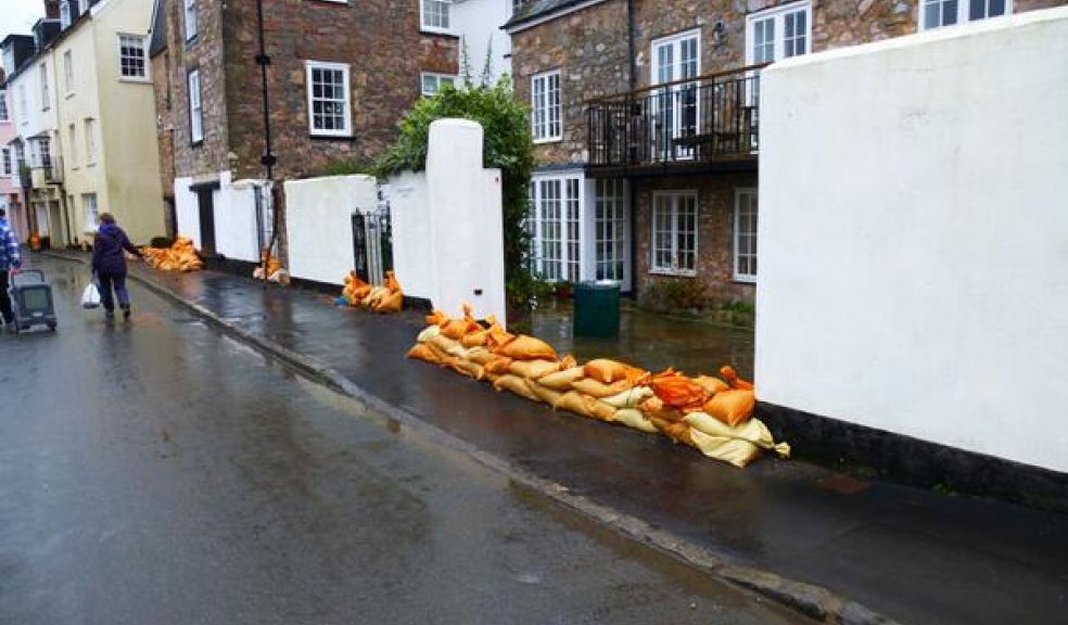
The City Council has again warned people to remain vigilant against flooding and take steps to protect their homes using sandbags provided by the council.
Residents in Topsham are among those to have been issued with sandbags.
The City Council will also have a workforce in the town to help people as the week goes on.
The authority is urging anyone whose homes may be at risk to protect their properties and any other possessions that may come into contact with flood water, such as cars parked close to the River.
The Environment Agency has issued a flood alert for the River Exe area as the river will begin to rise in the early hours of today (Tuesday) morning.
The Agency which currently has nearly 150 flood warnings and severe flood warnings in place across the UK came under fresh criticism over the weekend as Communities’ Secretary, Eric Pickles, said the Agency had “made a mistake” by not dredging in Somerset sooner.
Mr Pickles who is currently co-ordinating the flood response also suggested that the Government had become too reliant on the Environment Agency.
Speaking to the BBC, Mr Pickles said: "We made a mistake, there's no doubt about that. We perhaps relied too much on the Environment Agency's advice. I am really sorry that we took the advice … we thought we were dealing with experts."
Head of the Agency and former Labour cabinet minister, Lord Smith, hit back at the criticisms claiming that ministers are "playing politics" with the flood crisis and "getting in the way of decent people doing a valiant job".
Lord Smith, who is currently the subject of a petition to have him fired (organised by victims of the flooding in the Somerset levels), argued that government budget cuts and "value-for-money" rules imposed by the Treasury limited the Environment Agency's response.
Acting City Council leader Rosie Denham wrote in support of the Agency on twitter saying: “Feeling sorry for @EnvAgency staff who are today getting a taste of the bile normally reserved for councils from Eric Pickles.
“Still no admission from Government that significant cuts to Environment Agency funding contributed to flood risk.
“South West desperately needs real action from Government, not just a pathetic blame game from ministers.”
Picture courtesy of Exeter City Council.


