Severe flood warnings against loss of life in Exmouth and Sidmouth
The Environment Agency has warned of life-threatening flooding around the Devon Coast.
The agency has issued 14 ‘Severe’ flood warnings ahead of further extreme weather conditions including for the communities around Exmouth and Budleigh Salterton.
Low lying and exposed communities between Exmouth and Lyme Regis, including sea front areas of Exmouth, Budleigh Salterton, Sidmouth and Seaton are asked to be aware of the severe warning and take immediate action to stay safe.
Warnings have also been issued for the coastline between between Start Point and Dawlish Warren, including Beesands, Torcross, Slapton, Torbay, Dawlish and as far down as Plymouth.
A 'Severe' warning has also been issued for Plymouth Barbican including the Sutton Harbour.
Severe flood warnigs have also been issued in Low lying or exposed parts of coastal communities in North Devon, including Clovelly, Westward Ho!, Watermouth Cove, Combe Martin, Lynmouth and areas around Ilfracombe, including Cheyne Beach, The Quay, The Strand and Broad Street.
There are severe concerns against further flooding as more heavy wind and rain is due to hit Devon in the early hours of tomorrow morning.
A further 61 flood warnings requiring immediate action against flood have been issued in the South West region.
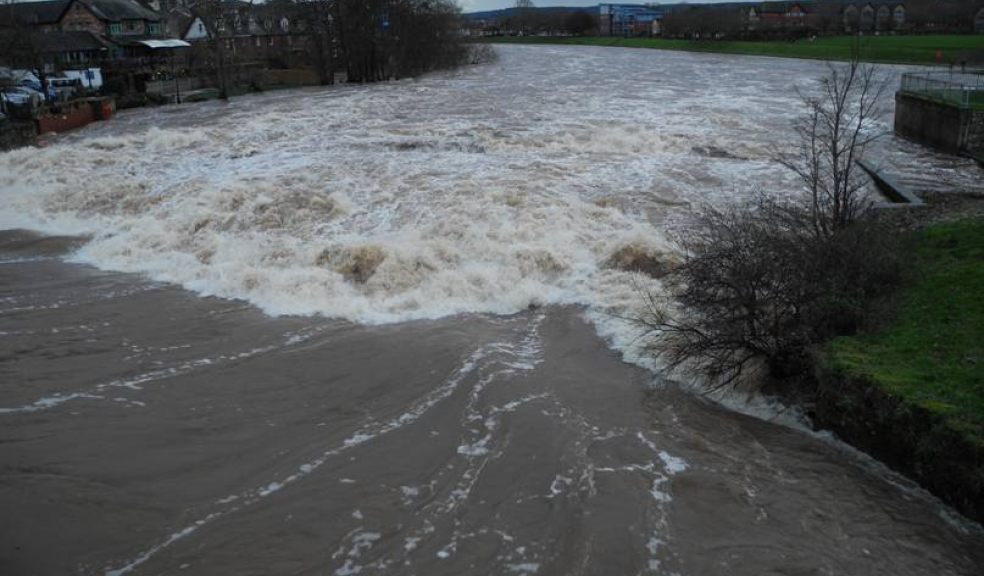
50 pre-emptive flood alerts which indicate a strong possibility of flooding have been issued around the South West including on the River Exe near Tiverton and Teignbridge.
There is particular risk of flooding in Coastal areas due to the combination of very high tides with severe wind.
The public should be aware that Devon and Somerset Fire and Rescue Service are expected to be functioning with a reduced staff list due to a strike by the Fire Brigades Union (FBU) tomorrow morning
The strike is due to take place between 6:30am to 8:30am, during the height of the weather warning.
During the storms on Christmas Eve, striking firefighters in Kent voluntarily returned to work due to the extraordinary weather so there is a provision for the firefighters to return to work should it prove necessary.
Met Office forecasters have issued a Yellow Weather Warning for the South West, a statement on their website reads: “Another spell of unsettled weather is expected on Friday with further wet and windy conditions likely across western areas in particular.
“Tides will be very high, and the public should be aware of the risks of large waves and coastal flooding.”
The Met Office Chief Forecaster also warned that: "Another spell of wet and windy weather will affect the British Isles on Sunday as a new, deep depression becomes anchored over the eastern Atlantic Ocean. The associated frontal system is then expected to move eastwards across Britain, perhaps not clearing the far east and southeast until Monday morning.
"Outbreaks of rain, heavy at times, will affect the UK on Sunday. Quite widespread accumulations of 10-20 mm are then likely with locally in excess of 40 mm possible over some higher ground.
"This additional rainfall, following the recent wet weather, means that the public should be aware of an increased risk of both surface water and river flooding as well as disruption to transport."
A second weather warning has also been issued for Sunday.
Devon and Cornwall police have asked that people stay out of the sea during the next few days of bad weather following two people going either missing or drowned while swimming in the last two days.
This includes a 27-year-old man who went missing in the early hours of New Year’s Day after night-swimming in Cornwall with a group of friends in stormy weather.
A body has been found this morning and although not formally identified, next of kin have been informed.
Councillor Stuart Hughes, the Council's Cabinet Member responsible for highways maintenance and flooding, said that he's heard from a member of the public who has had his car damaged by waves washing pebbles and shingle onto the road.
He said: "The big concern at present is the risk of coastal flooding over the next few mornings, especially tomorrow (Friday).
"This is due to combination of very high tides, a surge and very large waves. Some properties along the coast will be at risk of flooding.
"Where road users encounter standing water on the road, I urge them to please slow down. Bow waves caused by driving too fast through standing water can damage other people's property.
"And with high winds and high tides expected, I recommend not parking on Esplanades or coastal roads, and that the public stay clear of sea walls or fast flowing, swollen rivers. As dramatic as it is, the conditions can be risky and we do not want people putting themselves or others in danger."
Defra’s Secretary of State Owen Paterson today chaired an emergency COBR meeting today to prepare ahead of this week’s predicted storms.
Speaking after the COBR meeting, Environment Secretary Owen Paterson said: “With a number of flood warnings in place today and more rain and high winds forecast for tomorrow, I have today chaired a COBR meeting to make sure that across central government departments we are ensuring that local councils, utilities and transport companies are as prepared and ready to respond as possible.
“The Environment Agency and local authorities are working hard in areas that could be affected and are on the ground ready to take any necessary actions.
“I urge everyone in affected areas to sign up to the Environment Agency flood warnings and follow the advice they issue to protect themselves and their properties.”


